Cool Stuff
There are a lot of blogs out there that put blog posts in various categories. Mine doesn't, but if it did, this would go under "Software You didn't Know You Needed"
Most digital cameras record various bits o' data along with the photo, including such things as the date & time and various camera settings (shutter speed, aperture, focal length, sensitivity, etc.). Some modern cameras will even save GPS data as well, but unfortunately, my camera doesn't have a built-in GPS receiver, or even an option for a "strap-on" GPS receiver, so my digital files don't get this data automatically saved with it. Assuming I remember to bring & turn on my hand-held GPS receiver, I could get this data for my own reference, or I could use various web sites to extract the data from maps later on (though this isn't so accurate because I often think I was at one location, and in reality I was several meters or a block off).
I recently discovered a piece of software, GPSPhotoLinker, that will download tracking data from a GPS unit, and add the GPS data to the images based on a time-weighted average of the GPS track data and the timestamp of the image. So, assuming your GPS unit and camera clocks are in sync, and depending on the sample rate of the GPS track data, I can quickly add accurate positional metadata to my images. As a bonus, GPSPhotoLinker will even add City, State & Country metadata based on the positional data.
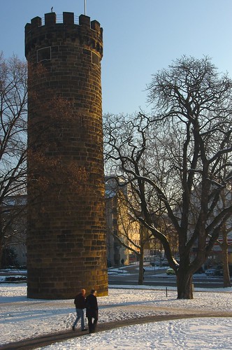
OK, I am sure at least some of the 4 of you out there that read this blog are asking "Who Cares?" and maybe even rolling your eyes and thinking "Useless file bloat!" Well, I disagree. There are some fun applications for this - like Geobloggers (at this time it is temporarily down) that will let you explore the world in the form of pictures. I can navigate to various parts of the world and see pictures from that place, which is pretty darn cool. And someone even wrote an application that will "fly" to that location in Google Earth (which *finally* has an OS X version!), which is way cool. Click the picture above, to go to the image on Flickr, and then click the "fly to this location" link and see what I mean. I am having a blast flying around and seeing Flickr images linked to their position in the world.
Of course, if you do check out my geotagged photos on Flickr, you'll see that I don't get far away from home...
posted by Allanimal @ 15:52
0 Comments
![]()
![]()

0 Comments:
Post a Comment
Subscribe to Post Comments [Atom]
<< Home